Understanding Yosemite’s Wildfire Recovery in 2026
Wildfires are an important part of California’s natural environment, but they can also create serious challenges for communities, visitors, wildlife, and businesses. For Mariposa County, where Yosemite National Park is a major part of the local economy and regional identity, wildfire recovery affects far more than the landscape. It can influence road access, recreation, air quality, emergency preparedness, tourism, and the everyday lives of residents.
In 2026, wildfire awareness remains especially important for people who live in Mariposa County and those planning to visit Yosemite. The year has brought several fire-related developments in the region, including the Dome Fire inside Yosemite National Park in September. According to CAL FIRE’s incident reporting, the Dome Fire burned approximately 6,788 acres and reached 100% containment on October 17, 2026. Although containment is a significant milestone, it does not automatically mean every affected trail or area is safe to reopen.
The distinction between containing a wildfire and completing recovery is essential. Fire crews may bring a blaze under control, but park managers can still need time to assess unstable trees, damaged trails, erosion risks, and other hazards. Visitors may encounter temporary closures even when the wider park remains open.
For residents, recovery may involve monitoring evacuation information, preparing properties for future fire seasons, checking local emergency resources, and supporting businesses that depend on tourism. For visitors, it means researching current road conditions, following official closure notices, and remaining flexible when planning hikes, camping trips, and scenic drives.
This guide explains what Yosemite wildfire recovery means in 2026, how it can affect Mariposa County, where to find reliable updates, and what residents and travelers can do to protect themselves while helping the region recover.
Important update: Conditions can change quickly. This article provides information available as of October 20, 2026. Always verify current conditions and restrictions with official agencies before traveling or making safety decisions.
1. What Is Happening With Yosemite Wildfire Recovery in 2026?
Wildfire recovery is a long-term process that begins while firefighters are still working to control a fire. It includes restoring safe access, evaluating environmental damage, protecting infrastructure, monitoring hazards, and helping affected communities prepare for future emergencies.
The Dome Fire is a significant example of why recovery requires more than extinguishing flames. The fire began on September 15, 2026, near Wawona Dome in Yosemite National Park. It burned through forested terrain and areas associated with previous fire activity. As reported by CAL FIRE, the incident reached 6,788 acres and 100% containment by October 17.
Containment means that firefighters have established control lines or other measures intended to prevent the fire from spreading beyond the perimeter. It does not mean that every burned area has cooled completely, that all hazards have disappeared, or that every closed road and trail can immediately reopen.
Following a wildfire, park officials must evaluate where trees have been weakened, where the ground may be unstable, and where firefighting operations or smoke conditions create additional risks. These assessments help determine which areas can safely accommodate hikers, campers, employees, and emergency personnel.
The National Park Service maintains official fire updates and closure information for Yosemite. Its information should be treated as the primary reference for determining which areas are accessible and which remain restricted.
Readers can review the latest announcements through the National Park Service Yosemite Fire News page and check the CAL FIRE incident information website.
For Mariposa County, the broader lesson is that wildfire recovery is not a single event with a clearly defined finish date. It is an ongoing process that requires coordination among emergency services, land managers, local government, businesses, and residents.
2. Why Wildfire Recovery Matters to Mariposa County Residents
Yosemite National Park attracts visitors from across the United States and around the world. Many travelers use Mariposa County communities as a starting point for park visits, overnight stays, dining, shopping, and outdoor recreation. When a wildfire affects part of the region, its consequences can extend beyond the fire perimeter.
Even when flames remain inside the national park, smoke may travel into nearby communities depending on wind direction, atmospheric conditions, and the intensity of the fire. Roads can experience temporary restrictions, and businesses may need to adjust schedules when visitors change their travel plans.
Residents may also face increased concerns about defensible space, evacuation routes, insurance, and the safety of homes located near forests or areas with heavy vegetation. These issues remain relevant even after a particular incident reaches containment.
For households that depend on tourism-related employment, changes in visitor numbers can affect working hours and income. Restaurants, lodging providers, tour operators, gas stations, retailers, and other local businesses may experience cancellations or shifts in demand when travelers are uncertain about access.
Recovery can also create opportunities for communities to strengthen preparedness. Residents can use lessons from recent incidents to review emergency plans, identify evacuation routes, update contact information, and discuss neighborhood communication procedures.
Local recovery resources are particularly important for households that have suffered property damage or other losses. Mariposa County maintains an official recovery information portal with links and guidance for people affected by fires and other emergencies. Visit Mariposa County Recovers to explore available resources and contact information.
Residents should avoid assuming that every wildfire-related program applies to every incident. Eligibility requirements, financial assistance, and available services can vary according to the disaster, the type of loss, and the responsible agency.
The most useful approach is to treat recovery as both a community effort and a personal responsibility. Staying informed, preparing in advance, and sharing verified information can help reduce confusion when conditions change.
3. Which Yosemite Areas Are Open After a Wildfire?
One of the most common questions visitors ask after a wildfire is whether Yosemite National Park is open. The answer may depend on the specific entrance, road, campground, trail, or recreation area a person plans to visit.
A fire affecting one part of Yosemite does not necessarily close the entire park. In some situations, the majority of visitor destinations remain accessible while a smaller area is closed for firefighting, safety inspections, or environmental protection.
The opposite can also be true: an open park does not guarantee that every familiar destination is available. A trail may remain closed because of falling-tree hazards, damaged bridges, unstable slopes, or the need to protect restoration work.
As of the information available on October 20, 2026, Yosemite’s official conditions page lists several main access routes as open, while also identifying roadwork and possible delays. Conditions in and around fire-affected areas should be checked separately before departure.
Visitors should consult the official Yosemite Current Conditions page and the Yosemite closures page before making travel arrangements.
These pages are more useful than relying on an old travel article, a social media photograph, or an online map that may not reflect temporary restrictions.
Check the exact destination, not just the park entrance
Suppose you are staying in Mariposa and planning to visit Yosemite Valley. You should verify the status of your intended entrance, the roads you will use, parking arrangements, and any trail closures that may affect your itinerary.
If your destination is Wawona or an area near a recent fire perimeter, check for additional restrictions before leaving your lodging. Do not assume that a road is safe simply because it appears on a navigation app.
The same principle applies to camping. A campground may have separate reservation requirements or seasonal operating dates, and nearby trails may have different access rules.
Travelers should also avoid entering closed areas to take photographs of burned trees or to get a closer view of the fire’s effects. Closures protect visitors from hazards that may not be visible from a road or trailhead, and they allow crews to complete their work safely.
Plan alternatives before arriving
A flexible itinerary can make a trip less stressful. Identify a few alternative viewpoints, short walks, or community attractions outside any restricted areas. Keep reservations and cancellation policies in mind, and do not rely on a single trail or scenic stop as the centerpiece of an entire trip.
If conditions change while you are already in the region, follow posted signs and directions from park staff. An official detour may take longer, but it is safer than trying an unfamiliar route that has not been verified.
4. How Wildfires Affect Yosemite’s Forests and Wildlife
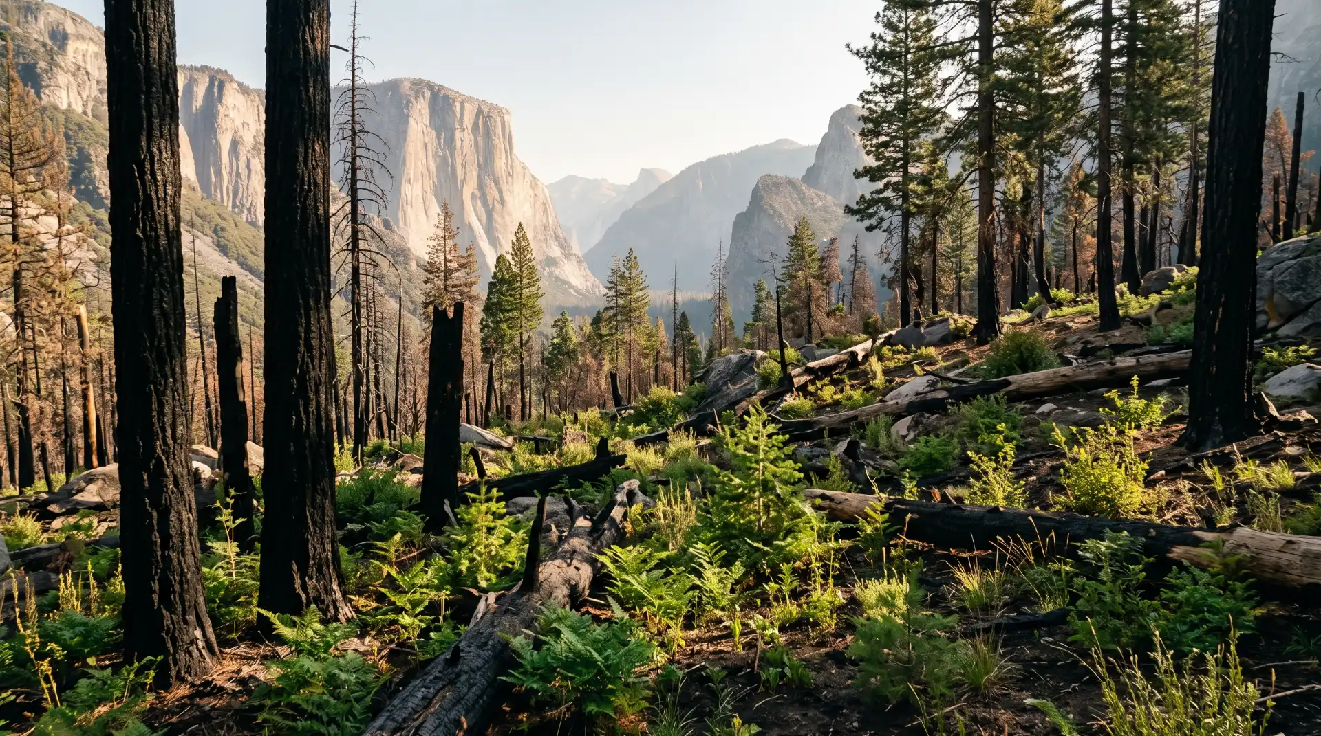
Wildfire damage is often easiest to recognize in the form of blackened trunks, scorched branches, and exposed ground. However, the ecological effects are more complex than the appearance of a burned forest suggests.
Fire can alter vegetation, soil conditions, water movement, animal habitat, and the availability of food and shelter. The effects depend on the fire’s intensity, the type of forest, the weather, the slope, and the condition of the landscape before the fire occurred.
Some plants are adapted to periodic fire and can regenerate from surviving roots, seeds, or protected parts of the plant. Other vegetation may take longer to return, especially where severe burning damages soil properties or where drought limits new growth.
A forest recovering from fire may show a patchwork of conditions. Some areas can retain living trees and relatively intact vegetation, while nearby sections may have extensive tree mortality. This variation is one reason recovery assessments need to consider individual locations rather than treating every burned area as identical.
Wildlife may also respond in different ways. Animals can move to less affected habitat, change feeding patterns, or use newly available vegetation as it returns. Some species may benefit from changes in habitat structure, while others may lose nesting areas, cover, or food sources.
For visitors, these changes create opportunities to learn about forest ecology, but observation must be done responsibly. Do not approach wildlife, feed animals, remove plants, or enter restricted habitat. Disturbing animals can add stress during a period when they may already be responding to changes in their environment.
Why dead trees remain dangerous
A tree that has been damaged by fire can remain standing for a period before its branches or trunk fail. The danger may not be obvious to someone walking beneath it. Wind, rain, and the gradual breakdown of damaged wood can increase the risk of falling limbs or entire trees.
Fire can also create unstable ground, hidden holes around burned roots, and weakened trail edges. These conditions may remain hazardous long after visible flames have disappeared.
For that reason, visitors should stay on authorized trails and obey temporary closures. Even experienced hikers should not assume they can judge the safety of a fire-damaged forest by appearance alone.
How natural recovery takes place
Recovery may involve natural regeneration, targeted restoration, erosion control, invasive-plant monitoring, and the removal of hazards where appropriate. Managers must decide which actions are necessary for public safety and ecological health.
Not every burned area should be cleared or replanted immediately. Some landscapes recover through natural processes, and management decisions may differ according to local conditions and conservation priorities.
The goal is not simply to make a burned forest look green again. Effective recovery considers soil stability, habitat, water quality, biodiversity, and the long-term resilience of the landscape.
5. Smoke and Air Quality: What Residents and Visitors Should Know
Wildfire smoke can affect people far from the flames. Fine particles in smoke can irritate the eyes and respiratory system, and exposure may be particularly concerning for people with asthma, heart or lung conditions, older adults, children, and people who are pregnant.
Smoke exposure varies throughout the day. Wind direction, temperature, terrain, and changing fire activity can cause conditions to improve or deteriorate within a relatively short period. A clear morning does not guarantee that the afternoon will remain smoke-free.
Residents should monitor local air-quality readings when smoke is present and pay attention to official health guidance. The AirNow website provides air-quality information and resources for understanding pollution levels.
Visitors should check conditions for the actual places they plan to visit rather than relying on a single regional reading. Air quality can differ between Yosemite Valley, higher elevations, Mariposa, and other nearby communities.
Adjust outdoor activities when smoke increases
If air quality deteriorates, consider shortening hikes, moving strenuous activities indoors, or postponing outdoor exercise. People who are especially sensitive to smoke should follow advice from their healthcare professionals and local public-health authorities.
A well-fitted respirator designed to filter fine particles may reduce exposure in some circumstances, but it does not make every outdoor activity safe. It also does not protect against every gas or chemical found in smoke.
For people staying in hotels, vacation rentals, or homes, keeping windows and doors closed during periods of heavy smoke may help reduce indoor exposure. A suitable portable air cleaner can improve indoor air quality, provided it is used correctly and maintained according to the manufacturer’s instructions.
Avoid bringing smoky clothing and equipment into sleeping areas when possible. If smoke is persistent, check local guidance for recommended precautions and locations where people can seek cleaner indoor air.
Do not use smell alone to judge safety
Smoke odor is not a reliable substitute for air-quality information. Some people may notice smoke at relatively low particle concentrations, while others may underestimate conditions that are harmful to their health.
Use current monitoring data alongside official advisories and your own symptoms. If you experience significant breathing difficulty, chest pain, or another medical emergency, seek appropriate medical assistance.
6. Wildfire Safety for Visitors Planning a Yosemite Trip
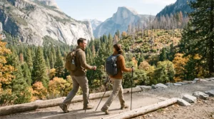
A successful Yosemite visit begins with preparation. Visitors do not need to cancel every trip because wildfire is a possibility, but they should understand that access, weather, and safety conditions can change.
Start by checking official alerts a few days before departure, then review them again on the morning of travel. If you are visiting for several days, continue checking updates throughout your stay.
Travelers arriving from outside California should not assume that conditions remain the same between the time they book their trip and the date they arrive. Fire incidents, smoke, roadwork, and weather can all affect the practical details of a visit.
Prepare a flexible travel plan
Save your lodging information, park entrance details, and alternative routes before driving into areas where mobile service may be limited. Download maps for offline use, carry enough drinking water, and ensure your vehicle has adequate fuel.
If your itinerary includes hiking, research the distance, elevation change, expected conditions, and any relevant restrictions. Choose activities appropriate for your fitness level and experience. Do not start a long hike late in the day simply because a shorter destination is temporarily unavailable.
Keep an eye on weather forecasts as well. Rain can create slippery trails and may affect burned slopes, while wind can influence smoke conditions and fire behavior.
Follow evacuation instructions immediately
If officials issue an evacuation order for your location, leave as directed. Do not delay departure to collect nonessential belongings, take photographs, or wait for additional confirmation from unofficial sources.
Know the difference between an evacuation warning and an evacuation order, and understand the instructions used by the relevant authorities. Keep your phone charged, maintain access to emergency alerts, and let someone know your travel plans when appropriate.
If a road is closed, do not drive around barriers or follow other vehicles into a restricted area. Closures may protect against fire, falling trees, smoke, active emergency operations, or unsafe road conditions.
Practice responsible campfire safety
Human-caused fires can be prevented through careful behavior. Visitors should follow current fire restrictions, use only permitted facilities, and never leave an authorized fire unattended.
Do not assume a campfire is allowed because a campground is open. Restrictions can apply across large areas and may be stricter than ordinary campground rules.
The National Park Service publishes information about current Yosemite fire restrictions. Review those rules before lighting a fire, using outdoor cooking equipment, or smoking in permitted locations.
When restrictions prohibit wood or charcoal fires, comply with the rules even if other visitors appear to be ignoring them. A single careless action can put lives, homes, forests, and local livelihoods at risk.
7. How to Follow Official Yosemite and Mariposa County Updates
During wildfire season, timely information can make a significant difference. Residents and visitors should rely on agencies responsible for the location and type of information they need.
For park access, trail restrictions, campground status, and park-specific fire updates, the National Park Service is the main source. For incidents managed by California fire agencies, CAL FIRE provides incident information and official updates. Local evacuation information should come from the responsible county or emergency agency.
These resources serve different purposes. A fire incident page can describe containment and firefighting activity, while a park conditions page can identify road status and recreation restrictions. Neither should automatically be treated as a substitute for local evacuation instructions.
Verify information before sharing it
Wildfire rumors can spread quickly through social media, neighborhood groups, and travel forums. Old photographs may be reposted as if they show current conditions, and outdated reports may continue circulating after a road reopens or a restriction changes.
Before sharing a claim, check its publication date and confirm whether the agency has issued a newer update. Look for the precise location involved, because reports about one community or trail may not apply to another.
If someone asks whether Yosemite is open, avoid giving an unqualified yes or no without context. Explain that park access and closures vary by location and direct the person to the official conditions page.
This approach reduces confusion and helps residents and travelers make decisions based on current information.
8. The Economic Impact of Wildfire Recovery on Local Businesses
Tourism is an important part of the Mariposa County economy. Visitors support lodging providers, restaurants, shops, transportation services, guides, and many other businesses. Wildfires can affect these businesses even when their properties remain undamaged.
News of a fire may lead travelers to postpone reservations or assume that an entire region is inaccessible. In reality, the impact can vary considerably by location. Some businesses may continue operating normally while specific roads, trails, or destinations are restricted.
This creates a challenge for local business owners. They must communicate accurate information, manage changing reservations, and respond to questions from people who may be unfamiliar with Yosemite’s geography.
Communicating clearly with customers
Businesses can help customers by providing current information about their own operating status and directing visitors to official sources for road closures, park access, and evacuation notices.
Accommodation providers should explain relevant cancellation or change policies clearly. Restaurants and retailers can update their operating hours where appropriate and avoid sharing unverified claims about fire conditions.
Accurate communication benefits visitors as well as businesses. Travelers who understand which areas are open can make better decisions about where to stay, eat, shop, and explore.
How visitors can support the community
When authorities confirm that an area is safe and accessible, visitors can support the local economy by using local services and following responsible travel practices.
Consider dining at locally owned restaurants, purchasing supplies from community businesses, and booking authorized tours or activities. Respect private property, observe posted restrictions, and avoid interfering with emergency operations.
Visitors should not enter a damaged area simply to photograph it or seek out active fire lines. Responsible tourism means recognizing that local residents may be dealing with stressful circumstances even when the surrounding landscape appears peaceful.
Recovery funding and assistance
Depending on the incident, recovery may involve local government resources, state programs, federal assistance, nonprofit organizations, or private insurance. Not every program is available after every fire, and eligibility may depend on the nature and scale of the damage.
Residents and business owners should begin with official county information and the agencies responsible for the specific incident. Keep receipts, photographs, correspondence, and other relevant documentation when seeking assistance.
Be cautious about unsolicited offers promising guaranteed grants, immediate payments, or special access to disaster funds. The county warns that disaster-related fraud can occur. Verify assistance programs directly with the relevant agency before providing sensitive information or paying fees.
9. How Residents Can Help With Long-Term Forest Recovery
Wildfire recovery is not limited to emergency agencies. Residents can contribute by supporting responsible restoration efforts, sharing verified information, and learning how fire affects local ecosystems.
One useful starting point is to follow updates from Yosemite’s fire management and natural-resource teams. Official information can explain why certain areas remain closed, which restoration activities are underway, and what visitors should expect during the recovery process.
Community members can also look for volunteer opportunities through established conservation organizations and public agencies. Before participating in a cleanup or planting project, confirm that the activity is authorized and appropriate for the affected site.
Avoid disturbing recovering areas
Walking or driving into a burned landscape without permission can damage fragile ground, disturb wildlife, and interfere with restoration work. Removing wood, plants, rocks, or other natural materials may also violate park regulations or damage habitat.
Stay on designated routes and respect temporary barriers. If an area is closed, choose another location rather than trying to find an informal way around the restriction.
Understand the role of prescribed fire
Prescribed fire is a planned land-management tool used under specific conditions by trained professionals. It differs from an uncontrolled wildfire because it is intentionally ignited and managed according to an approved plan, with attention to weather, fuel conditions, objectives, and safety.
Prescribed burning can help reduce certain accumulations of combustible vegetation and support ecological goals. However, it requires careful planning and can temporarily affect smoke and local access.
Residents should pay attention to official announcements about prescribed burns in and around Yosemite. Smoke from planned fire-management activities can sometimes affect communities even when no emergency wildfire is present.
Support science-based restoration
Forest recovery decisions should be guided by ecological conditions, public safety, and the needs of the affected landscape. Planting trees may be appropriate in some places, while other areas may recover naturally or require different interventions.
Residents can help by supporting credible conservation work, respecting closures, and learning from reliable scientific and agency resources rather than assuming that one restoration method is suitable everywhere.
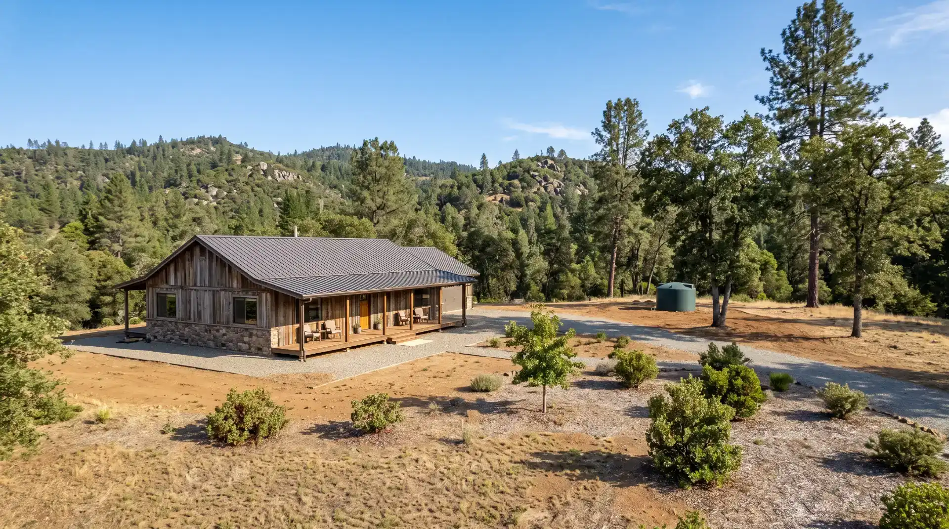
10. How Mariposa County Homeowners Can Prepare for Future Wildfires
For homeowners, wildfire recovery is closely connected to wildfire prevention. Although no property can be made completely fireproof, sensible preparation can reduce certain risks and improve the chances that a home will be easier for firefighters to defend.
Start by evaluating the immediate area around the house. Dry leaves, dead branches, firewood, and other combustible materials can accumulate near walls, decks, porches, and outbuildings. Regular maintenance can reduce the amount of readily available fuel near vulnerable structures.
Keep roofs and gutters free of accumulated leaves and needles where it is safe to do so. Check that exterior vents and other openings have suitable protection consistent with applicable building standards. Review the condition of decks, fences, sheds, and other structures that connect vegetation to the home.
The area immediately surrounding a house deserves particular attention. Remove dead vegetation and manage plants in ways that reduce continuous pathways for fire to reach structures. More distant vegetation may also need thoughtful management, depending on the property’s slope, surrounding forest, and local recommendations.
Homeowners should consult local fire officials or qualified professionals for advice tailored to the property. Requirements and best practices can differ by location, and cutting down every tree or removing all vegetation is not necessarily appropriate or environmentally beneficial.
Create defensible space thoughtfully
Defensible space refers to the managed area around a structure that can help reduce wildfire exposure and provide firefighters with a safer working environment. Its purpose is to reduce the intensity with which fire can reach a home and limit the amount of combustible material close to the building.
In practice, this can mean keeping vegetation maintained, removing dead materials, separating combustible items from structures, and considering how plants, fences, and outdoor furniture are arranged.
Pay attention to access as well. Clearly marked addresses, usable driveways, and unobstructed routes can help emergency personnel find and reach a property.
Residents should check applicable California and local requirements rather than relying solely on generic online advice. The CAL FIRE Ready for Wildfire resource offers information on defensible space, home hardening, and evacuation preparation.
Prepare an emergency kit
A household emergency kit should include drinking water, food that does not require extensive preparation, essential medications, a first-aid kit, flashlights, batteries, phone chargers, important contact details, and supplies for pets.
Keep copies of essential documents in a secure, accessible location. Store digital copies of insurance information, property records, identification, and emergency contacts where they can be accessed if the original documents are lost.
Review insurance coverage before an emergency occurs. Understand the policy’s limits, deductibles, exclusions, and procedures for reporting damage. Keep an updated record of possessions and property conditions using photographs or video stored securely.
Plan for everyone in the household
An evacuation plan should account for children, older adults, people with mobility limitations, pets, and anyone who may need additional assistance. Identify more than one possible route when available, and agree on a communication plan in case family members are separated.
Do not wait for an evacuation order to decide what to take or where to go. Preparing in advance allows people to leave more quickly when authorities issue instructions.
11. Planning a Responsible Visit to Yosemite During Recovery
A wildfire recovery period does not necessarily mean visitors should avoid the entire region. Instead, travelers should plan around current restrictions, follow official advice, and understand that the landscape may look different from photographs taken before the fire.
Some visitors may notice blackened trees or patches of altered vegetation along an otherwise open route. These changes can be a reminder of the risks facing California forests, but they should not become an excuse to approach dangerous or closed areas.
Choose activities that fit the conditions and remain willing to change plans. If smoke increases, a road closes, or an official alert changes the safety situation, prioritize safety over completing the original itinerary.
Travelers can also help reduce pressure on emergency services by following fire restrictions, driving carefully, keeping vehicles out of restricted areas, and reporting an immediate hazard through the appropriate official channel.
For people visiting from outside the region, a little preparation goes a long way. Check your route, carry water and essential supplies, save key phone numbers, and make sure someone knows your itinerary if you plan to hike in remote areas.
Most importantly, remember that the people who live and work around Yosemite are part of the landscape’s recovery story. Treat local communities with respect, follow their guidance, and recognize that emergency response and restoration work can continue long after the most dramatic images of a fire disappear from the news.
Frequently Asked Questions About Yosemite Wildfire Recovery in 2026
Is Yosemite National Park open after the 2026 Dome Fire?
Yosemite is not necessarily closed in its entirety because of the Dome Fire. Official conditions information lists accessible roads and identifies specific restrictions, but the status of individual trails and locations can change. Check the National Park Service’s current conditions and closure pages immediately before traveling.
Has the Dome Fire been contained?
CAL FIRE reported that the Dome Fire reached 100% containment on October 17, 2026, after burning approximately 6,788 acres. Containment does not mean all fire-related hazards have disappeared, and temporary closures can remain in effect while officials evaluate safety conditions.
Is it safe to hike in a burned forest?
Not every burned forest is unsafe, but fire-damaged areas can contain unstable trees, falling branches, hidden holes, and damaged trails. Hike only where access is authorized, follow posted restrictions, and never enter a closed area to inspect the damage.
Can wildfire smoke affect Mariposa even if the fire is inside Yosemite?
Yes. Smoke can travel beyond a fire’s perimeter, and its effects depend on wind, weather, terrain, and fire activity. Check local air-quality readings and follow public-health advice when smoke is present.
What should Mariposa County residents do to prepare for future wildfires?
Residents should maintain appropriate defensible space, reduce combustible materials near buildings, prepare emergency supplies, review evacuation routes, organize important documents, and monitor official alerts. Property-specific guidance is available through CAL FIRE’s Ready for Wildfire resources.
Where can residents find wildfire recovery assistance?
Start with the official Mariposa County recovery portal at mariposacounty.gov/recovers. The resources available will depend on the incident, the type of loss, and eligibility requirements. Confirm details with the responsible agency before applying for assistance.
Can visitors still support Mariposa County businesses during recovery?
Yes, when the areas they plan to visit are open and safe. Visitors can support local restaurants, lodging providers, retailers, and authorized tour operators while following current road conditions, park restrictions, and emergency guidance.
Conclusion: Recovery Requires Preparation, Patience, and Community Support
Yosemite wildfire recovery in 2026 is a reminder that protecting California’s natural landscapes and the communities around them requires long-term effort. The Dome Fire’s reported containment is an important milestone, but it does not remove every risk or automatically reopen every affected trail and area.
For Mariposa County residents, this is an opportunity to strengthen household preparedness, maintain properties responsibly, monitor official information, and support recovery efforts that respect local ecosystems. For visitors, it is a reason to plan carefully, check current conditions, follow fire restrictions, and remain flexible when conditions change.
Wildfires can affect tourism, transportation, public health, wildlife, and local businesses, but accurate information and responsible decisions can help reduce their impact. Residents and visitors alike have a role in preventing new fires, respecting closures, and protecting the region’s long-term well-being.
Before your next Yosemite trip, review the National Park Service’s current conditions, check the latest fire information, and make sure your plans reflect the actual status of your destination. A thoughtful approach helps keep visitors safe while supporting the people and places that make Mariposa County special.
Editorial note: This article reflects information available as of October 20, 2026. Wildfire conditions, road access, air quality, and restrictions can change. Consult official agency updates before making travel or safety decisions.